Jason Azar
Design//Research
Westcott Interior/Exterior Graphics Program
Page Southerland Page, Inc. - Houston, TX
Designed and produced construction documentation for interior and exterior signage and graphics at The Laurel, a Greystar community in Austin, TX.
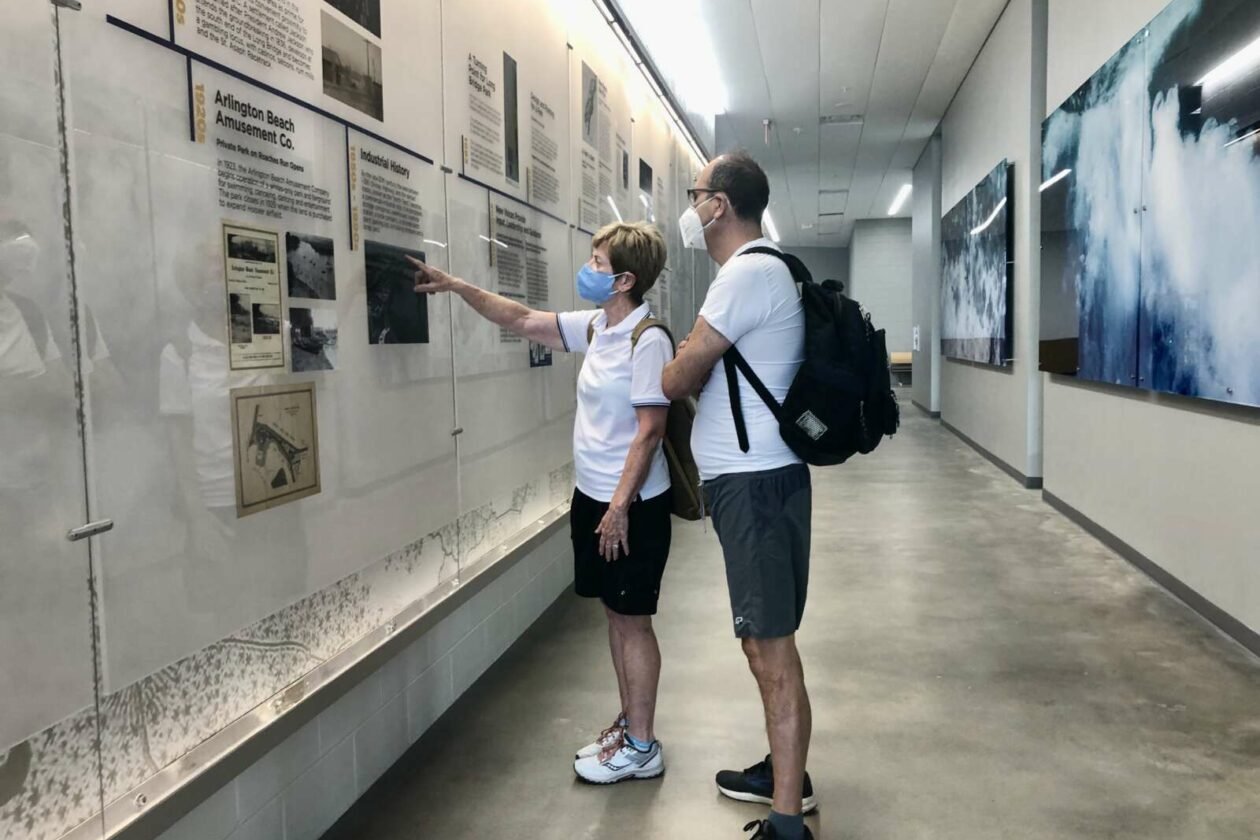
Long Bridge Park Aquatics and Fitness Center Interior Graphics Program
Page Southerland Page Inc. - Arlington, VA
Designed and produced installation documentation for interior signage and graphics including an immersive timeline, large scale wall murals, and custom glass prints.
Stuart Wietzman School of Design Signage
Page Southerland Page, Inc. - Philadelphia, PA
Designed and produced construction documentation for new exterior signage at the the Stuart Wietzman School Of Design at the University of Pennsylvania.
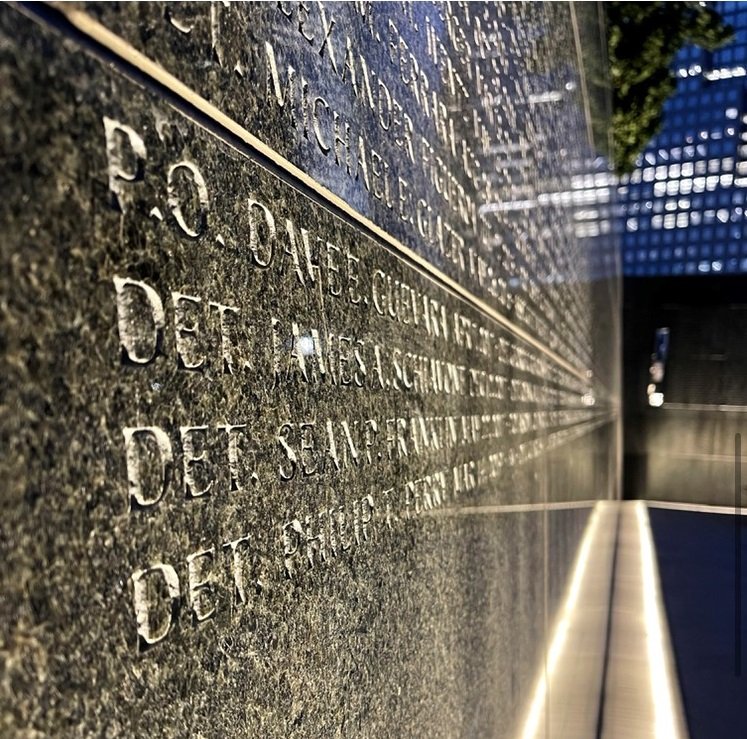
Battery Park Police Memorial Expansion
Page Southerland Page, Inc. - New York, NY
Designed name placement template for the newly expanded Battery Park Police Memorial at the southern tip of Manhattan.
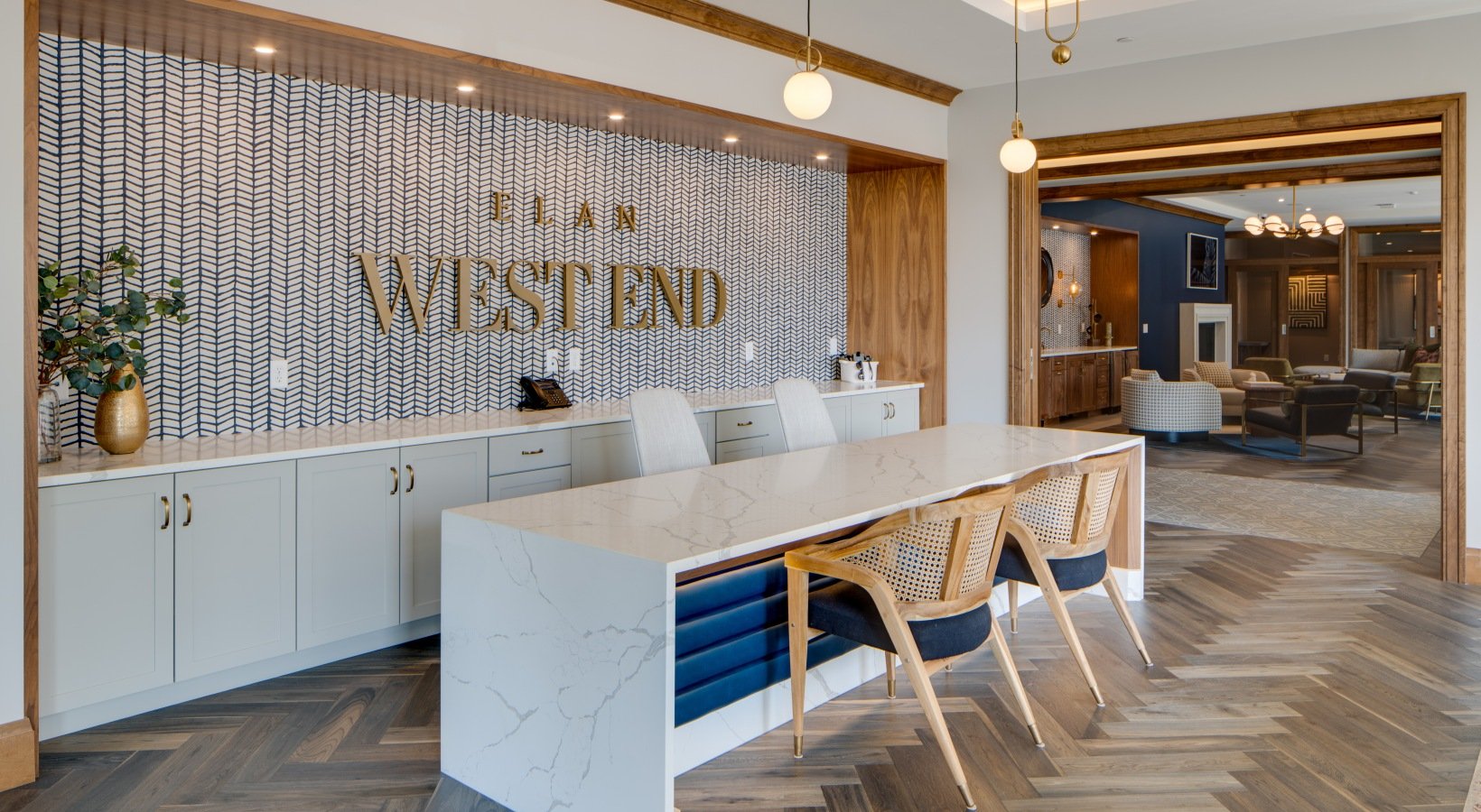
Elan WestEnd Interior/Exterior Graphics
Page Southerland Page, Inc. - Minneapolis, MN
Designed and produced construction documentation for interior and exterior signage and graphics at Elan West End, a Greystar community in Minneapolis, MN.
Pease Park Exterior Signage
Page Southerland Page, Inc. - Austin, TX
Designed and produced installation documentation for exterior signage at Pease Park, including the monument entry wall, mile markers, map posts, and safety signage
St. Phillips College Graphics Program
Page Southerland Page, Inc. - San Antonio, TX
Designed and produced construction documentation for interior and exterior graphics at St. Phillips College and Artemisias training restaurant in San Antonio, TX
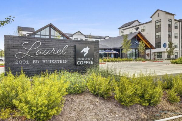
The Laurel Interior/Exterior Graphics Program
Page Southerland Page, Inc. - Austin, TX
Designed and produced construction documentation for interior and exterior signage and graphics at The Laurel, a Greystar community in Austin, TX.
Downtown Austin Trail Map
Volunteer Design for the Trail Foundation
Designed a map highlighting the major landmarks adjacent to the downtown Austin Hike and Bike Trail for use in promotional material.
LivCor Riata Paint Scheme Design
Page Southerland Page, Inc - Austin, TX
Developed new paint schemes for the entire Raita multi-family community, comprising of more than 120 buildings including multi-family buildings, leasing, and amenity centers,
Interactive Resource for Affordable Housing Locations
DMA Companies - Austin, TX
Developed an interactive online resource to layer policy and incentive zones for the investigation of potential locations for affordable housing .
Interactive Resource for Qualified Opportunity Zones
Realized Holdings, Inc. - Austin, TX
Developed an interactive online resource to layer national Qualified Opporunity Zones (QOZ) with census derived statistics and data for the investigation of QOZ investment potential.
Educational Pylon System
TBG Partners - Houston, TX
Designed artwork and fabrication drawings for a system of educational interactive pylons at The Groves masterplanned Community in Houston, TX.
Sienna Plantation Community Marketing Map
TBG Partners - Missouri City, TX
Lead design for development of a community map for Johnson Development Corporation and the Sienna Plantation Marketing team.
World Wall Map
Page Southerland Page, Inc - Washington D.C
Designed a wall map for the international headquarters of Page Southerland Page, Inc. for the tracking of the firm’s projects around the world.
San Francisco International Airport Wayfinding and Campus Planning
City-ID - San Francisco, CA
Worked as part of the City-ID design team to produce product concept illustrations, design terminal and campus maps, and perform research on the naming and numbering nomenclature employed by the airport and other international airports in the US and abroad.
Rio Texico Ranch Property Sale Exhibit
TBG Partners - Brewster County, TX
Design lead on exhibit series for conservation land offering from King Land and Water.
Summerwind Trails Community Trails Map
TBG Partners - Calimesa, CA
Lead designer for development of a master trails map for Argent Management and the Sumemrwind Trails Marketing team.
John Peter Smith Health Network Internal Signage and Wayfinding Program
TBG Partners - Fort Worth, TX
Design team member on custom wayfinding and signage program.
Bay Area Metropolitan Transportation Commission Wayfinding
City-ID - San Francisco, CA - 2017
Worked as part of the City-ID design team to produce product concept illustrations, whole journey planning scenarios, workshops, surveys, as well as completing extensive research into the Bay Area’s numerous transportation authorities.
Industrial Intermediaries: Alternative Futures to Industrial Rehabilitation in San Antonio, TX
Masters Thesis - Parsons School of Design - 2018
Thesis project to explore the capacity of rehabilitation projects to build community wealth through cooperative ownership and management.
Bay Area Ford GoBike Bikeshare
City-ID - San Francisco, CA - 2017
Worked as part of the City-ID design team to design station maps for the Ford GoBike Bikeshare program in San Francisco. Responsibilities included design and development of regional maps, design and development of pictograms and icons, and design and development of station maps.
Artavia Entry Primary Entrance Monumentation
TBG Partners - Conroe, TX
Design team member on entry monument for Artavia community.
Long Island Railroad Station Improvements
City-ID - New York, NY - 2017
Worked as part of the City-ID design team to update Long Island Railroad signage and message schedules to current ADA standards and to correspond stylistically with other transit brands operating within the New York Tri-State area.
Sienna Plantation Levee Improvement District Web Map
TBG Partners - Missouri City, TX
Design team member for the development of a series of web maps for the parks under the purview of the Sienna Plantation Levee Improvement District.
intraBlock systems to aid overcrowded schools
Studio - Parsons School of Design - 2016
Concept to utilize vacant lots and modular building systems to provide immediate and low-cost relief to an overburdened school system in Sunset Park, Brooklyn. Presented to Friends of Sunset Park community group and Make Space for Quality Schools Sunset Park community group.
Bay Area Ford GoBike Bikeshare
City-ID - San Francisco, CA - 2017
Worked as part of the City-ID design team to design a custom icon family for the Ford GoBike Bikeshare program in San Francisco.
Let's Make a Plan: Revealing Hierarchies in the East Harlem Neighborhood Plan (2016)
Studio - Parsons School of Design - 2016
Let’s Make a Plan is a collaboratively designed board game that reveals the hierarchies and levels of participation by different participant groups in the 2016 completed East Harlem Neighborhood. Played in groups of 4-5, the game educates participants on the power of different participant groups in the creation of the neighborhood plan.
Trinity University Riverwalk Connection Concept
Studio - Trinity University - 2015
Concept to build a pedestrian land-bridge over a highway to connect Trinity university and nearby neighborhoods to the headwaters of the San Antonio River.
Student Center Terrace Concept
Studio - Trinity University - 2013
Concept to convert the roof of the Trinity University student center into an accessible terrace with a garden and seating designed and maintained by students.


